Chronology of Indian Environmental Laws


In the Constitution of India it is clearly stated that it is the duty of the state to ‘protect and improve the environment and to safeguard the forests and wildlife of the country’. It imposes a duty on every citizen ‘to protect and improve the natural environment including forests, lakes, rivers, and wildlife’. Reference to the environment has also been made in the Directive Principles of State Policy as well as the Fundamental Rights. The Department of Environment was established in India in 1980 to ensure a healthy environment for the country. This later became the Ministry of Environment and Forests in 1985.

The constitutional provisions are backed by a number of laws – acts, rules, and notifications. The EPA (Environment Protection Act), 1986 came into force soon after the Bhopal Gas Tragedy and is considered an umbrella legislation as it fills many gaps in the existing laws. Thereafter a large number of laws came into existence as the problems began arising, for example, Handling and Management of Hazardous Waste Rules in 1989.

Following is a list of the environmental legislations that have come into effect:
General
Forest and wildlife
Water
Air


General

1986 – The Environment (Protection) Act authorizes the central government to protect and improve environmental quality, control and reduce pollution from all sources, and prohibit or restrict the setting and /or operation of any industrial facility on environmental grounds.

1986 – The Environment (Protection) Rules lay down procedures for setting standards of emission or discharge of environmental pollutants.

1989 – The objective of Hazardous Waste (Management and Handling) Rules is to control the generation, collection, treatment, import, storage, and handling of hazardous waste.

1989 – The Manufacture, Storage, and Import of Hazardous Rules define the terms used in this context, and sets up an authority to inspect, once a year, the industrial activity connected with hazardous chemicals and isolated storage facilities.

1989 – The Manufacture, Use, Import, Export, and Storage of hazardous Micro-organisms/ Genetically Engineered Organisms or Cells Rules were introduced with a view to protect the environment, nature, and health, in connection with the application of gene technology and microorganisms.

1991 – The Public Liability Insurance Act and Rules and Amendment, 1992 was drawn up to provide for public liability insurance for the purpose of providing immediate relief to the persons affected by accident while handling any hazardous substance.

1995 – The National Environmental Tribunal Act has been created to award compensation for damages to persons, property, and the environment arising from any activity involving hazardous substances.

1997 – The National Environment Appellate Authority Act has been created to hear appeals with respect to restrictions of areas in which classes of industries etc. are carried out or prescribed subject to certain safeguards under the EPA.

1998 – The Biomedical waste (Management and Handling) Rules is a legal binding on the health care institutions to streamline the process of proper handling of hospital waste such as segregation, disposal, collection, and treatment.

1999 – The Environment (Siting for Industrial Projects) Rules, 1999 lay down detailed provisions relating to areas to be avoided for siting of industries, precautionary measures to be taken for site selecting as also the aspects of environmental protection which should have been incorporated during the implementation of the industrial development projects.

2000 – The Municipal Solid Wastes (Management and Handling) Rules, 2000 apply to every municipal authority responsible for the collection, segregation, storage, transportation, processing, and disposal of municipal solid wastes.

2000 – The Ozone Depleting Substances (Regulation and Control) Rules have been laid down for the regulation of production and consumption of ozone depleting substances.

2001 – The Batteries (Management and Handling) Rules, 2001 rules shall apply to every manufacturer, importer, re-conditioner, assembler, dealer, auctioneer, consumer, and bulk consumer involved in the manufacture, processing, sale, purchase, and use of batteries or components so as to regulate and ensure the environmentally safe disposal of used batteries.

2002 – The Noise Pollution (Regulation and Control) (Amendment) Rules lay down
such terms and conditions as are necessary to reduce noise pollution, permit use of loud speakers or public address systems during night hours (between 10:00 p.m. to 12:00 midnight) on or during any cultural or religious festive occasion

2002 – The Biological Diversity Act is an act to provide for the conservation of biological diversity, sustainable use of its components, and fair and equitable sharing of the benefits arising out of the use of biological resources and knowledge associated with it


Forest and wildlife

1927 – The Indian Forest Act and Amendment, 1984, is one of the many surviving colonial statutes. It was enacted to ‘consolidate the law related to forest, the transit of forest produce, and the duty leviable on timber and other forest produce’.

1972 – The Wildlife Protection Act, Rules 1973 and Amendment 1991 provides for the protection of birds and animals and for all matters that are connected to it whether it be their habitat or the waterhole or the forests that sustain them.

1980 – The Forest (Conservation) Act and Rules, 1981, provides for the protection of and the conservation of the forests.

Water

1882 – The Easement Act allows private rights to use a resource that is, groundwater, by viewing it as an attachment to the land. It also states that all surface water belongs to the state and is a state property.

1897 – The Indian Fisheries Act establishes two sets of penal offences whereby the government can sue any person who uses dynamite or other explosive substance in any way (whether coastal or inland) with intent to catch or destroy any fish or poisonous fish in order to kill.

1956 – The River Boards Act enables the states to enroll the central government in setting up an Advisory River Board to resolve issues in inter-state cooperation.

1970 – The Merchant Shipping Act aims to deal with waste arising from ships along the coastal areas within a specified radius.

1974 – The Water (Prevention and Control of Pollution) Act establishes an institutional structure for preventing and abating water pollution. It establishes standards for water quality and effluent. Polluting industries must seek permission to discharge waste into effluent bodies.
The CPCB (Central Pollution Control Board) was constituted under this act.

1977 – The Water (Prevention and Control of Pollution) Cess Act provides for the levy and collection of cess or fees on water consuming industries and local authorities.

1978 – The Water (Prevention and Control of Pollution) Cess Rules contains the standard definitions and indicate the kind of and location of meters that every consumer of water is required to affix.

1991 – The Coastal Regulation Zone Notification puts regulations on various activities, including construction, are regulated. It gives some protection to the backwaters and estuaries.


Air

1948 – The Factories Act and Amendment in 1987 was the first to express concern for the working environment of the workers. The amendment of 1987 has sharpened its environmental focus and expanded its application to hazardous processes.

1981 – The Air (Prevention and Control of Pollution) Act provides for the control and abatement of air pollution. It entrusts the power of enforcing this act to the CPCB .

1982 – The Air (Prevention and Control of Pollution) Rules defines the procedures of the meetings of the Boards and the powers entrusted to them.

1982 – The Atomic Energy Act deals with the radioactive waste.

1987 – The Air (Prevention and Control of Pollution) Amendment Act empowers the central and state pollution control boards to meet with grave emergencies of air pollution.

1988 – The Motor Vehicles Act states that all hazardous waste is to be properly packaged, labelled, and transported.


The above laws have been sourced from:
Environmental policy-making in India – The process and its pressure, TERI report.
Indian Environmental Legislations, list from the MOEF web site.
Strengthening Environmental Legislations in India, document by Centre for Environmental Law, WWF.

3,000 villages in Maharashtra may face acute drinking water shortage by year-end | The Indian Express

https://indianexpress.com/article/india/3000-villages-in-maharashtra-may-face-acute-drinking-water-shortage-by-year-end-5436651/


Indus Water Treaty – A Panel Discussion on Lok SabhaTV and an essay by Prof. Manohar Khushalani

Study on Water Management of the Indus River System
and its Implications for India’s Foreign Policy by Prof. Manohar Khushalani

Background

Two-thirds of India’s water resources potential come from only two river basins namely, the Indus and Ganga-Brahmaputra-Meghna (GBM). India occupies a unique position in this respect. There is abundance of Water and Hydro Power potential within the country and in its neighbouring states. The potential can be used both constructively as well as destructively.

India, Nepal, Bangladesh, Bhutan, Tibet, all share the Ganga- Brahmaputra- Meghna River basin. The Indus River Basin is shared by Tibet, Pakistan, India and Afghanistan

Pakistanis complain that numerous new Indian projects on the Jhelum and Chenab will create substantial live storage even in run-of-the-river hydel dams. This will empower India to reduce flows to Pakistan during the crucial sowing season, something that actually happened for a couple of days when the Baglihar reservoir was filled by India after dam completion. If as a result of better coordination between the two countries the dam had been filled up during monsoons it would have actually helped Pakistan . Understanding each other’s needs and constraints the key.

The average supply of water that reaches Pakistan is 104 million acre feet while the water that is consumed is 70 million acre feet. “The mismanagement in Pakistan was resulting in the loss of 34 million acre feet of water”, informed Mr. Qureshi when asked by Pak media as to whether Pakistan had taken up the issue, in Thimphu , of India trying to block the flow of rivers.

The total area of the Indus Basin, the area draining the, Himalayan water into the Arabian Sea, is about 365,000 square miles (934,000 sq.km), larger than Pakistan’s total area. The Indus River system consists mainly of the Indus River and its major eastern tributaries, the Jhelum, Chenab, Ravi, Beas and Sutlej Rivers. A number of rivers join the Indus on its west side. The largest is Kabul with its main tributary, the Swat River

The Indus Water Treaty is well known. The Treaty gave India exclusive use of waters of the eastern rivers, Ravi, Beas and Sutlej. Pakistan was given those of the western rivers – the Indus, Jehlum and Chenab. The division of the Indus river waters is a parallel of the partition of land between India and Pakistan.

Signed in 1960 by Prime Minister Jawaharlal Nehru and the then Pakistan President Ayub Khan, the Indus Water Treaty was brokered by World Bank. It is an surprisingly over generous water-sharing treaty, and is the only pact in the world that compels the upper riparian state to defer unequally to the interests of the lower riparian state.

The treaty gives Pakistan control over the three so-called “western” rivers – that flow from Jammu and Kashmir before entering Pakistan. On the other hand, India gets to control the three eastern rivers – Ravi, Beas and Sutlej that flow from Punjab.

This so called parity in the number of rivers is, however, quite misleading. It was what would constitute a himalyan blunder. The three rivers that India gets to control have an awfully low volume of waters compared to the other three. In all, Pakistan gets a whopping 80 MAF of water every year which is a massive 84 per cent share of the total waters, while India gets to use only 16 per cent. (Source: Wikipedia)

However it contained provisions for India to establish run-of- the-river power projects with limited reservoir capacity and flow control needed for feasible power generation. Availing the provision, India established several run-of-the-river projects most of which were not objected to by Pakistan. However, in case of Baglihar and Kishan-Ganga projects, Pakistan claimed that some design parameters were more lax than needed for power generation and provided India with excessive ability to accelerate, decelerate or block flow of river. This, it was felt, may give India a strategic leverage in times of tension or war.

During 1999-2004 India and Pakistan held several rounds of talks on the design of projects, but could not reach an agreement. After failure of talks on January 18, 2005 Pakistan raised six objections and took up the matter with the World Bank, which was a broker and signatory of Indus Water Treaty. In April 2005 the World Bank determined Pakistani claim as a ‘Difference’, a classification between less serious ‘Question’ and more serious ‘Dispute’ and in May 2005 appointed Professor Raymond Lafitte, a Swiss civil engineer, to adjudicate the difference.

Lafitte declared his final verdict on February 12, 2007, in which he partially upheld some objections of Pakistan declaring that pondage capacity be reduced by 13.5%, height of dam structure be reduced by 1.5 meter and power intake tunnels be raised by 3 meters, thereby limiting some flow control capabilities of earlier design. However he rejected Pakistani objections on height and gated control of spillway declaring these were conforming to engineering norms of the day.
Both parties (India and Pakistan) have already agreed that they will abide by the final verdict. This peaceful settlement of the only major discord in nearly half a century is an even greater achievement, considering the fact that the two neighbors have gone to war thrice on other issues.

On the flip side, according to one estimate, the Kabul river accounts for 20 to 30 MAF of total annual flows, the main Indus 100 MAF and the Jhelum and Chenab 60, while the Ravi, Beas, and Sutlej add another 40 MAF or so. Looking at it mathematically, India gave far more water to Pakistan than it got. Secondly China has built Senge-tsangpo hydropower station with cap of 6400 mw tributaries and upper reaches of Indus in the Ngari Prefuncture of Tibet, with no objections raised by Pakistan.

India has made large investments in water infrastructure, much of which brings water to previously water-scarce areas and some of it diverts water from flood prone areas. This has resulted in an economic shift, with once-arid areas or previously flood prone zones becoming the centers of economic growth, while the traditionally well-watered areas have seen comparatively sluggish growth. For the most part the results of this “hydraulic infrastructure platform” have been spectacular both nationally (through the production of food grains and electricity, for example) and regionally (where such projects have generated large direct and equally large indirect economic benefits). The poor have benefited hugely from such investments. The incidence of poverty in irrigated districts is one third of that in unirrigated districts .

The privatisation of Power has also contributed to this growth. The Mushrooming growth of large scale Hydro Power companies such as JP Hydro, Larsen and Toubro, GVK Power, Tata Power have contributed to greater availability of this clean source of power. Partial privatization of public sector companies such as NHPC and Power Grid Corporation has improved the climate for this source of power. Even the hitherto coal and gas based power generators such as NTPC have turned to Hydro Power. This augurs well for hydropower in India.

The first decade of the millennium has been marked by what has often been described as oil wars – confrontation over dwindling hydrocarbon fuel resources. Will the next decade be marked by confrontation over water and hydro energy, or will it be known for cooperation over sharing the natural resources?

How India manages its relations with its neighbours is going to be a key to the kind of economic progress it can make along its borders. Water is a key issue in its relationship with its neighbours. Even though it is a renewable resource it cannot be denied that fresh water is a dwindling resource. The key to India’s relationship with Pakistan, which have been largely conflict ridden, is a sharing of the waters of the Indus Basin, which could in fact be considered to be one of the success stories and perhaps an example for the rest of the world about how seemingly intractable bones of contention can be resolved through a rational and conciliatory approach.

Instead of going through the complications of assessing water requirement downstream of each of the rivers, a metaphorical knife was used to cut off and hand over three rivers to Pakistan and three to India. On the face of it, since all the six rivers of the Indus Basin run first through India and then go to Pakistan it seemed to be a brilliant stroke of statesmanship – an apparently visionary approach which made India willingly part with three of the six rivers even while it retained the right to draw power through run of the river schemes on those three rivers. Has the policy worked successfully only because India might have given more than it got? Out of the three bilateral issues, namely one in Baglihar, a conflict of interest arose which was resolved amicably. What about the other pending bones of contention namely the Tulbul Navigation Project and the 330MW Kishenganga Project? The negotiations stalled for long.
The unprecedented 2010 floods in Pakistan may have abated but the havoc caused by them have cast an unimaginable havoc on its economy. Conservative September estimates suggested that over 2000 persons had died and 21 million became refugees in their own country. Secondary damages to agricultural land and animal husbandry will take years to recoup. At one point about one-fifth of Pakistan’s total land area had gone under water. Flood waters had destroyed crops; an estimated 700,000 acres of cotton, 200,000 acres each of rice and sugar cane and 300,000 acres of wheat. This heavily impacted the agricultural economy which contributed 20.4% of Pakistan’s GDP in the earlier year. The cascading effect into industry and trade is has added to its economic woes.
Scientists have described this catastrophe as a once-in-a-century flood. Out of a Population of 168 million nearly 21 milion people have been affected by floods out of a total area of Pakistan of 796 095 square kilometers, the Flood-affected area is 160 000 square kilometers. In a country where already a large percentage of the population is living as refugees, an additional 1.85 million homes have been destroyed or damaged due to floods.
Pakistan is, thus at a fork in the road. It can either continue confrontationist policies which underlie present arrangements (or lack thereof) and face similar or perhaps bigger flood disasters in future, if anticipated climate change effects do materialise. Or it can chose to cooperate with countries in the Indus basin with a view to building an integrated system of storage dams, flood control installations and power generation stations which will help to modulate flows and avert floods, thereby benefitting Pakistan’s agriculture particularly its struggling farmers. The attendant hydropower potential is also huge and can be tapped for the energy-hungry Pakistani economy, as well as cross-border sales to India. The big question is whether the Pakistan’s rulers can change their confrontationist mindset to make this possible. If there was no deficit of trust India could have stored water even in the eastern rivers of the Indus basin to be used as a kind of buffer during floods. But, for that an integrated basin management is required, because the mighty rivers, follow their own course, they do not recognize man made political boundaries

For that a reality check is required in both the countries. A recent example of this was a very honest admission in 2010 by the former Pakistan Foreign Minister. While it is this kind of statesmanship and honesty that will help in getting a fresh look at this issue, on the other hand the sacking of the Pakistan’s Indus Commissioner, Syed Jamaat Ali Shah, who amongst other reasons was also discredited for making a similar pragmatic observation and the departure from Government of the pragmatic Shah Mehmood Qureshi, perhaps, indicates that moderates in Pakistan may not be able to mellow the debate.

There is a very good logic in understanding the socio-economic needs of the entire region namely Kashmir, Punjab in India and Pakistan, Pakhtoonkhwa, Sindh, Gujarat and Rajasthan. Assessing the genuine needs of populace in the two countries and trying to involve a cross border management plan for the entire region could perhaps become a key to breaking down the borders between the two countries and expanding the scope of cooperation in the region. Is it possible to achieve the impossible? But this is what all dreams are made of.

Of late, Pakistani militants, for lack of issues which could build up anti India sentiment, have started to focus on the Water as a contentious issue. It is therefore important to bring down the rhetoric by using an objective approach.

It will research long term implications for Indus basin countries (India, Pakistan and Afghanistan) in terms of water availability (for agriculture and individual consumption), hydropower, downstream economic impact , and social, political & security effects under (a) the present dispensation and (b) an optimally integrated river management along the lines of the Tennessee Valley Authority .


Kerala Floods As Water Level Rises, Mullaperiyar Dam In Kerala To Be Opened

The Tamil Nadu government, which owns and operates the dam located upstream of Idukki Dam, has informed that it may release water into the Periyar river on the Kerala side from Mullaperiyar reservoir due to higher inflows, an official release said.

Read More

https://www.ndtv.com/kerala-news/kerala-floods-as-water-level-rises-mullaperiyar-dam-in-kerala-to-be-opened-1900650


World’s Tallest Dam, Pancheshwar, an ambitious Indo-Nepal venture

About Pancheshwar Multipurpose Project

The Mahakali River basin, upstream from the proposed Pancheshwar High Dam site has drainage area of 12,100 Km2. PMP has been identified as a huge storage scheme to be developed so as to maximize peak power benefit in the order of 6,720 MW (Pancheshwar High Dam-6480 MW and Rupali Gad Re-regulating Dam-240 MW) with an annual average energy production of 12,333 GWh. The Poornagiri re-regulating dam is an alternative of Rupali Gad Re-regulating Dam from which additional 1000 MW power will be generated (PACO report, Additional Service, section 3, June 1992).
Location and Accessibility
The project area lies between 29° 07′ 30″ and 29° 48′ North latitude and 79° 55′ and 80° 35′ East longitude. It lies in the Mahakali zone of the Far Western Development Region of Nepal covering some parts of Darchula, Baitadi and Dadeldhura districts bordering India. At present, the Project site can be accessed by vehicle only through India. However, it can be accessed through Nepal by two days walking from Patan, Baitadi.
Pancheshwar High Dam
Pancheshwar High Dam project has been conceived as a huge storage scheme having a 315 m high rock fill dam with a central earthen core. With the “Normal Maximum Water Level” of 680 m elevation the reservoir area extends to 65 km upstream in Baitadi and Darchula districts. The crest length and the crest elevation would be 860 m and 695 m respectively. The “Normal Maximum Water Level” would provide live storage of 6.56 billion m3 of water and capable of generating 10,671 GWh of energy. Two identical underground powerhouses, one on each bank in Nepal and lndia of capacity of 324 MW have been proposed comprising 6 generating units of vertical Francis turbines having 540 MW capacity of each will be installed. Total installed capacity of the high dam project will be of 6480 MW.

A re-regulating dam at Rupaligad is conceived as integral component of PMP to minimise social and environmental Impacts due to high fluctuation of water level and flow in downstream when high dam power plants operate at peaking load. Poornagiri Re-regulating Dam has been identified as an alternative of the Rupaligad RRD.

Rupaligad Re-regulating Dam
An 83 m high concrete gravity dam on Mahakali River near Samniya settlement is proposed as Rupali Gad Re-regulating Dam which is about 25 km downstream from Pancheshwar High Dam. The dam site is located at about 1.75 km downstream from the confluence of Rupali Gad with Mahakali River in Dadeldhura District. At maximum water level of 420 masl, it stores 70 million m3 of water as live storage and produces 240 MW power with 1662 GWh of annual energy.

Poornagiri Re-Regulating Dam
This dam is located at 64 km downstream from High dam. DPR study of 1995 has proposed two options; (a) 117 m high rock fill dam, and (b) 124 m high concrete gravity dam. These are for re-regulating the water of the high dam. The power production of the dam is 1000 MW in both options.

Copyright © Pancheshwar Multipurpose Project.

Additional Information provided by Nepal Energy Forum

Pancheshwar project will have tallest dam in the world

Interview with Mahendra Gurung, CEO of Pancheshwar Development Authority

The proposal to build Pancheshwar Multi-purpose Project on the Mahakali River in far-western Nepal was floated by Nepal and India almost two decades ago. However, nothing happened for a long time. Things finally started moving forward when Indian Prime Minister Narendra Modi visited Nepal in August 2014. Then in September 2014, the governing body of the Pancheshwar Development Authority, the project implementing body, met for the first time. This led to formal establishment of the PDA. Recently, WAPCOS Ltd, an Indian state-owned company hired to prepare the detailed project report, submitted the final draft of the DPR. Report says Pancheshwar, along with Rupaligad project, can generate around 12 billion units of electricity per year. Rupak D Sharma of The Himalayan Times caught up with PDA CEO Mahendra Gurung to know more about findings of study conducted by WAPCOS.

WAPCOS has just submitted the final draft of detailed project report (DPR) of Pancheshwar Multipurpose Project. How different is it than the previous ones?

Nepal had initially prepared the DPR of Pancheshwar in 1995. Then in 2003, India came up with its own
project report. India had largely prepared the report based on data used in DPR prepared by Nepal. The 1995 DPR had said the installed capacity of the project would be 6,480 megawatts. But the latest report says the installed capacity of the project would be 4,800 MW. In other words, there has been a downward revision in the project’s installed capacity. This is one of the differences.

Why was the figure revised?

Although the 1995 DPR was said to have been prepared on the basis of studies conducted from 1962 to 1992, not all data were collected from the Mahakali River where the project is being built. It is now known that the report had also used data collected from Karnali Chisapani. Also, research has shown that the country had started keeping records of Mahakali River from 1985 or 1986. So, the 1995 DPR was prepared based on data collected since 1985 or 1986. But when WAPCOS Ltd conducted its study in 2015, it used the previous data and data obtained after 1995 as well. So, this study is more in-depth. During the course of study, WAPCOS found that the level of precipitation, or rainfall, had fallen for five consecutive years from 1995 to 2000, indicating reduction in water level in the river. This is one of the reasons why the installed capacity had to be revised. Another reason for downward revision is the provision in the Mahakali Treaty signed by Nepal and India in 1996, which says five per cent of the water in the river should not be used for electricity generation. This means the latest figure on installed capacity was derived without factoring in power that could have been generated through five per cent of the water in the river. However, in reservoir projects, like Pancheshwar, megawatt alone does not reflect the true picture. This is because electricity generation through reservoir projects depends on when and how the water is used.

Could you please elaborate on what you just said?

What I’m trying to say is reservoir projects give us the option to use all the water at once or use a certain quantity of water multiple times to generate electricity. So, the quantum of energy that we generate per annum is more important than megawatts. And the latest report shows the project can generate almost similar quantum of electricity as estimated in 1995. However, this is just a draft report. Now, governments of both the countries will have to review the findings and lay their suggestions, following which the DPR would be finalised.

WAPCOS has also submitted a report on development of Rupaligad re-regulating dam, isn’t it? What does it say?

Pancheshwar project is expected to release huge quantity of water for certain hours every day when electricity is being generated. If all the water released by the project is allowed to flow downstream, it’ll create havoc in settlements located on river banks. This is why we are building a re-regulating dam. This dam will regulate the flow of water released by Pancheshwar project to support irrigation in Nepal and India. The dam will also control floods. The 1995 DPR prepared by Nepal and the Indian report of 2003 had recommended that Rupaligad dam be built 25 km away from Pancheshwar’s dam site. But the latest report has said this distance is insufficient and has proposed development of Rupaligad dam at a distance of 27.5 km from Pancheshwar dam site. However, the installed capacity of the Rupaligad project has remained unchanged at 240 MW. Another good news is that annual energy generation capacity of this project has been revised upwards to around 1,500 or 1,600 gigawatt-hours (1.5 or 1.6 billion units).

Will these dams be quake resistant, as far-western region is also said to be earthquake prone area?

We had previously conducted geological study in the area where the projects are being developed. Recently, an in-depth seismic study was also conducted. Based on these studies, we have also reviewed the designs of the two dams. These dams will be able to withstand earthquakes of up to 8.5 magnitude.

How many families do you think need to be relocated from the project site?

The area where the project is being developed is mostly covered by hills and does not have many human
settlements. As per the latest data, 22,765 people will have to be relocated in Nepal. This is an indication that land acquisition will not pose a big problem for us. However, I don’t have exact data on Indian families that will be affected by Pancheshwar and Rupaligad projects. We will have to conduct a detailed study in this regard.

How big will the reservoir be?

The reservoir will stretch 65 km upstream from the Pancheshwar dam site. It can store six billion cubic metres of water.

And how tall will the dam be?

It would be around 315 metres tall. Once the construction of this dam is over, it would be the tallest in the world. However, some experts are against the idea of creation of tall dams. But had India not built Tehri Dam, which is one of the tallest dams in the world, Dhauliganga flood of 2013 would have swept away Haridwar and Rishikesh.

How much do you think would the entire project cost?

As per latest estimates, it would cost INR 300 billion (Rs 480 billion) to build the project. This cost includes construction of both Pancheshwar and Rupaligad projects. This means per MW construction cost of the project hovers around Rs 95 million. So, we can say this project is going to be one of the cheapest projects being developed in the country.

And how much do you think would it cost to generate each unit of electricity from the project?

The electricity production cost hovers around INR five-six (Rs eight to Rs 9.6) per unit. This price is
quite high considering the cost of electricity in India. So, we are scouting for options to reduce the production cost.

What if the energy produced by the project becomes surplus for Nepal. Against that backdrop, can Nepal sell electricity in India?

Mahakali Treaty says a portion of Nepal’s share of energy shall be sold to India. The treaty also says that the quantum of such energy and its price shall be mutually agreed upon by the two parties. So, we have the option of selling electricity to India. Currently, India has shown interest to purchase electricity from us. But it has said Nepal should explicitly say the quantum of energy that it intends to sell at the earliest. This is because India can create its energy policy based on the quantum of electricity that we plan to sell. Also, India has said electricity should be sold at a competitive price. We have delivered this message to the government.

How will Nepal and India share costs to develop the project?

Mahakali Treaty says the project cost will have to be borne by both the countries in proportion to the benefits they reap. However, as of now, we don’t know how much each country has to invest. We’ll discuss this matter in the coming days. What is currently known is that electricity generated by the project will be distributed equally. For this, power houses comprising six turbines with electricity generating capacity of 400 MW each will be built on two banks of the river. The power generated from one bank, which falls in the Nepali territory, will be used by Nepal and the power generated from the other bank, which falls in the Indian territory, will be consumed by India. However, we are yet to determine other benefits that the two countries are likely to reap from the project. Some other benefits of this project are irrigation and flood control. In terms of irrigation, India will benefit the most. This is because India has lots of agricultural land, whereas we don’t have much irrigable land in our territory. This means we will not be able to take maximum benefit from the irrigation project even though Nepal can exercise its prerogative over water use. Latest studies show that even if we supply water to all the agricultural land from Kanchanpur to Kailali through this project, we cannot irrigate more than 100,000 hectares of land. In contrast, India has already said the project will help it to irrigate 1.6 million hectares of land.

Mahakali Treaty had become a political hot potato some two decades ago and had even split one of the largest political parties? Do you think similar differences will surface this time?

Most of the political parties have now become mature. Also, most of the political leaders have been engaged in this project. For instance, the treaty was signed when Sher Bahadur Deuba of Nepali Congress was the prime minister. At that time, KP Sharma Oli of the Communist Party of Nepal-Unified Marxist Leninist had backed the treaty. He is now the country’s prime minister. Lately, it’s the Unified Communist Party of Nepal (Maoist) and its splinter groups that create obstructions for hydro projects. But the concept of the Pancheshwar Development Authority (PDA) had taken a concrete shape during the time when Pushpa Kamal Dahal (Prachanda) was the prime minister. At that time, the management structure of PDA was also created. Then during the time when Madhav Kumar Nepal was prime minister, Terms of Reference of PDA was framed. So, major political leaders are aware of Pancheshwar project. However, if the project hits a major roadblock, locals, who are tired of waiting for implementation of the project, would protest.

So when will the commercial operation of the project begin?

If everything goes smoothly, we’d be able to complete all pre-construction works within three years. During the pre-construction phase, we will divert the flow of water from the river through tunnels. We will be building eight diversion tunnels for the purpose. We will also have to build access roads and suspension bridges to link both the dam sites. Also, hydro-metrological stations have to be renovated or set up. Once these works are complete, it will take another eight to 10 years to build the projects. Within this period, some units (turbines) will come into operation. But at least 10 to 12 years will be required to fully complete the project. During my three-year tenure as CEO, I intend to initiate the work of building the tunnels. It is my wish to see prime ministers of both the countries inaugurate the work.

Lastly, what do you intend to do in 2016?

We will set up our headquarters in Mahendranagar. We will also start building suspension bridges and access road to link project sites. We will also renovate or set up hydro-metrological stations. Besides, we will also finalise administrative and financial by-laws to ensure smooth operation of PDA.

Source :
The Himalayan Times.
www.nepalenergyforum.com


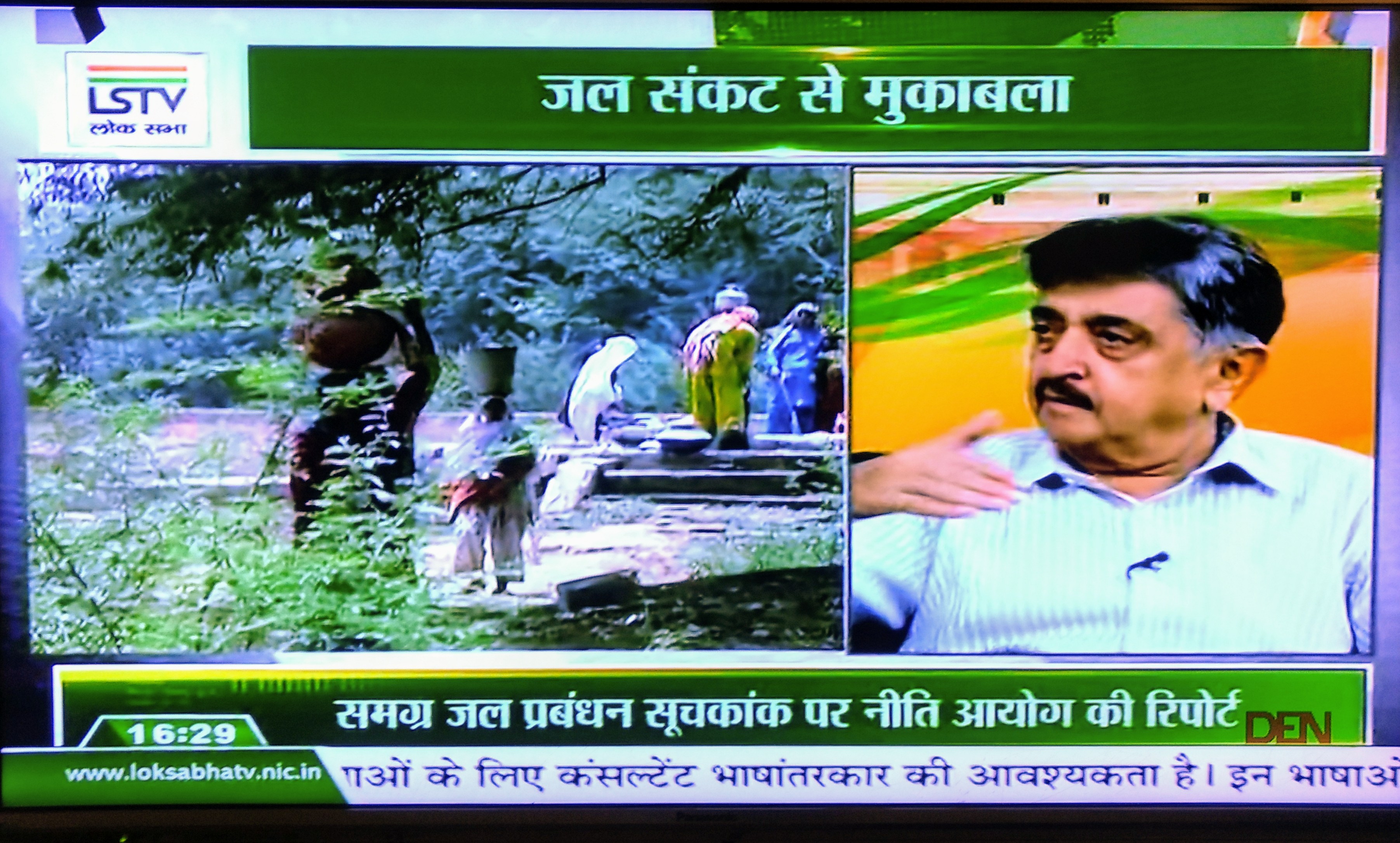
Niti Ayog report on water crisis in India by Manohar Khushalani

Manohar Khushalani appeared Live, as a Panelist in the Lok Sabha TV Program INSIGHT on, Monday, 18th June 2018 at 1 pm and again at 4 pm. The Discussions was on Niti Ayog’s Report, titled *‘Composite Water Management Index’ (CWMI)*, released by Minister for Water Resources Nitin Gadkari. We had an intense and productive discussion on Issues confronting the nation with respect to the water crisis in India and the world. My Co-panelists were Dr. Sudhendra and Dr. T. Haque. The latter was from Niti Ayog and therefore would carry our views to the think tank and we felt satisfied that our suggestions would be heard. I advise all those interested in water to listen to the YouTube recording of the discussion because it is full of information and will create awareness about issues facing us. As I said in the discussion, unless and until all people and nations come together on this the issue cannot be tackled. But I also say with confidence, that, if we work together on comprehensive water resource management we can conquer the crisis. So please watch this thought-provoking discussion and decide what role you yourself can play in saving the world for yourself and next generation:

https://m.youtube.com/watch?feature=youtu.be&v=5Dx7pL07y9Y


Watch “Interlinking of Rivers in India Part 1, Benefit of farmers or a natural disaster? Indian Geography” on YouTube


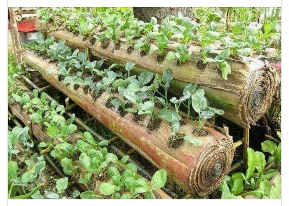
Unique concept in agriculture

In Indonesia, banana tree trunks are used for growing veggies. They dont need watering as this contains plenty of moisture. After harvesting, the trunk decomposes and enriches the soil.
Pls share this, let our gardeners / farmers too learn this beautiful and amazing way of saving water.


Instrumentation for Monitoring and Safety of Hydraulic Structures

DAM INSTRUMENTATION

1.0      INTRODUCTION

Instrumentation  which  is essentially a  technology  of   measurements and vital in all scientific investigations helps  in   monitoring  and evaluating the performance of dams  during  their   construction as well as during their operation.   Instrumentation   helps in checking the theories used in design, in validating  and   improving upon the design principles and discarding the erroneous   concepts.  Future behaviour of dams can be predicted and suitable   remedial   measures  can  be  undertaken  to   strengthen   them.    Instrumentation  also helps in verification of  new  construction   techniques  and  to  build  greater  confidence  among  engineers  responsible for maintenance and operation of dams.

The  instruments and instrumentation systems which  used  to  be  most often hydraulic, mechanical, pneumatic  and  electro-mechanical are gradually getting transformed into electronic ones   as they facilitate use of electronic data loggers and  computers.    At  major projects, where the instruments are installed in  large numbers,  it is desirable to go in for automation so  that  the   results  from  instrumentation data could be  made  available  as   quickly as possible for evaluating the health status of dams  and   for taking suitable remedial action, if warranted.

The failure of dams in the world is approximately one in   185; but it could be more in future due to faster pace with which   dams  are  being constructed.  While failure of  dams  cannot  be   completely avoided, it is possible to reduce the effect of  their   failure  on public life and property, if advance information  and   warning  could be provided by monitoring the dam behaviour  based   on the instrumentation data and timely measures are initiated  in   the  form  of  strengthening  of  dams  or  disaster  management.    Instrumentation  can also form a basis during legal  proceedings,   claims etc. after the failure of a dam.

A number of higher and higher dams are being constructed   in  the  relatively  unstable  Himalayan  geological  formations.    These dams have high risk consequences and therefore may need to   be  adequately instrumented.  The instrumentation of  foundations   should,  therefore,  be  extensive so  that  adequate  foundation   treatment is ensured after receiving feedback from them.

For successful implementation of instrumentation, it  is   necessary  that  the instruments and the  instrumentation  system   chosen  should be sufficiently sensitive, accurate, reliable  and   durable.   Additional  care  should  be  taken  while   selecting   instruments, that are buried and can not be retrieved later  for   servicing.   Again proper study and experience is required to  be   able  to  understand  as to what parameters are  required  to  be   monitored   for   planning   and   placement   of    instruments.  Instrumentation  with  respect to its location in Dam need  to  be absolutely   thorough   so  that  areas   critical   for   stress   determination  are  fully covered.  The  designer  should  infact   specify the critical points which need to be constantly monitored   and the frequency at which the collection of data and  monitoring  is to be done.

2.0       TYPE OF INSTRUMENTS

About  forty  yearas ago, geomechanics was still  a  new   science   and   market  for   instrumentation   hardly   existed.    Instruments  were installed only to monitor any  special  problem   encountered during construction.  Today geomechanics has  matured   as  a  science and instrumentation is invariably  specified  in   every  project  and  is  recognised  as  a  necessity  in   dams.    Instruments are now typically installed, read and interpreted  by   specialised    instrumentation   engineers   rather    than    by   manufacturers.

Instrumentation  technology  has advanced  very  rapidly   during  the recent years and it has become more  secure  with   more complex devices becoming quite common for use in dams.   The   instruments   available  since  the  beginning  of  the  era   of   instrumentation  can be classified into four categories, based  on   their principles of working viz.: Mechanical, Hydraulic, Pneumatic   and  Electrical/Electronic.  Initially mechanical  and  hydraulic   instruments were used extensively for instrumentation.   However,   with the passage of time and advancement of technology, pneumatic   and  electrical/electronic  instruments  have become  popular.    The   period since when these dam instruments are being used abroad and   in India is given below.

——————————————————

Instruments           Since when in use (years)

technology              abroad            India

——————————————————

  1.     Mechanical               60               45
  2.    Hydraulic                  60                40
  3. Pneumatic                 45                30
  4. Electrical/electronic    45            15-25

——————————————————

The   mechanical,hydraulic   and   pneumatic   type   of   instruments  are  simple, rugged, reliable, cheaper and  easy  to   operate  but  they have lower response and lower  accuracy.   The   electrical/electronic  instruments are highly sensitive and  have   high resolutions.

Off   late  the  use  of   Electrical/Electronic   type   instruments  are in vogue and these are being used extensively  in   instrumentation  of  dams.  The  electrical/Electronics  type  of   instruments  include  unbonded resistance type,  bonded  strain   gauge type and vibrating wire type.

Due  to  high rate of mortality among various  types  of   instruments,  erratic behaviour and lack of proper  calibration,   the  results  given by most of the instruments cannot  be  fully   relied   upon  except  in  the  case  of  vibrating   wire   type   instruments.

Bonded strain gauge type instruments are  suitable   for  surface installations and for short term observations.   The   unbounded  resistance type of instruments, though have long  term   stability  but  they  suffer from zero  shift,  cable  resistance variation are sensitive to temperature changes, moisture movements   and  have  short  life.  Thus, their  long  term  reliability  is   questionable.

The  vibrating  wire instruments  are  now  increasingly   being used in dam instrumentation.  These instruments are reliable,   sensitive,  accurate, durable and can be used with  modern  data   loggers  and computers.  In fact with vibrating wire  instruments,  instrumentation  can  be completely automated and these  can  be   read  and  interpreted  at even  far  off Central  control  rooms   through  satellites.   Other reasons for selection  of  vibrating   wire technology are :

  1. a) Splicing  of  instruments  leads  can  be  readily performed with little or no adverse impact upon the long-term performance of the system.
  2. b) The vibrating-wire cable can withstand abuse  during   the construction process and still function properly.
  3. c) When properly protected against lightening (primarily   by deep burial and adequate shielding of cables), vibrating wire   instruments have proved to be highly reliable.
  4. d) Vibrating-wire instruments require no maintenance and   can be  quickly and easily read at  central  reading

Selecting  vibrating-wire technology for piezometers,  settlement   sensors,  total  pressure cells, strain gauges and  joint  meters   permits  the  same  terminal  switching  stations  and  readout   equipment can be used for all these instruments.

Vibrating  wire  instruments are  however,  affected  by   temperature changes.  For this reason, each instrument includes  a   thermistor  so  that  the temperature changes  to  be  noted  and   compensated for.

As  regards, determining the number of  instruments  and   their exact type or location, their determination is primarily  a   matter of experienced judgement.


3.0   DEVELOPMENT OF INSTRUMENTATION TECHNOLOGY IN INDIA

Instrumentation Technology in India can be traced back  with   the  establishment  of  Engineering  Research  Institute  in  the   Irrigation  Depts  of  States with the  assistance  of  National   Physical Laboratory for transducer development.

Further,  after  Independence, a large number of  high  dams   were taken up for construction. For some of the dams,  Consultants   from  USA  and European countries were involved, with  the  result   that  the  State-of-art of dam instrumentation, as  available  in   advanced  countries could be introduced.  However,  indigenously   manufactured  instruments  have a very high rate of  mortality  and   could  not be relied upon. Added to this, the instrumentation  of   dams  was  not  carried  out in right  earnestness  with  the  result instrumentation  suffered  and  only a  few  instruments  yielded   reliable data.

The   vibrating  wire  type  instruments,  no  doubt   enjoy   advantages  but they are costly and most of their components  are   imported.  A  number of Indian firms have of late  entered  into   collaboration  with  foreign partner and  have  started  producing vibrating wire instruments. It is suggested that only those  firms   which   supply   vibrating  wire  instruments   with   ISO   9000   certification be used for dam instrumentation.

Moreover   due   to  lack  of   co-ordination   between   the   construction  contractors of dams and manufacturers/suppliers  of   the  instruments, the programme of installation of  instruments  and   their   accessories   and   the   successful   interpretation   of   instrumentation  data  could not  be  achieved.  It  is   therefore,   suggested  that  the  procurement,  installation  and  successful   operation of instruments should be a part of the main contract.

Central  Water  Commission has prepared guidelines  for  BIS   code on standardising the dam instrumentation. Still lot of  work   in standardising the dam instrumentation system need to be done.

In India we have 277 dams above a height of 30m and  another   116  dams are under construction(total 393 dams), out of  which  only   about 149 dams are known to be adequately instrumented.


 4.0  PARAMETERS TO BE MONITORED IN DAMS:

The  various parameters to be monitored and measured in  the   dams are: Uplift, Pore pressure, stress, strain, joint movements,   horizontal  and  vertical displacement,  foundation  deformation,   deflection,   surface   movement,   seepage,   temperature    and seismicity.

Various  instruments used for monitoring these parameters  in   dams are tabulated below:

PARAMETERS                    INSTRUMENTS                      WHERE APPLICABLE

I.Uplift/pore                            1.Twintube Hydraulic piezometers

water  pressure                     2.Pneumatic piezometers

3.Vibratingwire   piezometers

4.Unboundedelectric resistance piezometers

5.Bonded Electric  resistance piezometers

6.Multipoint  piezometers  with packers

7.Multipointpiezometers  surrounded with grout

8.Multipointpushin piezometers.

9.Porous tube piezometers

10.Slottedpipe  piezometers.

11.Pore pressure cells.


  1. Seepage 1.Buckets and stop watch

2.Weirs

3.Flumes

4.Flow meters

5.Velocity meters

6.Geophysical seepage monitoring

7.Water quality meters

8.Resistivity test


III.Strain                                                   1.Elastic  wire   strain  meters

2.Vibrating  wire   strain  meters.

3.Reinforcing meters

4.Nostressstrainmeters


IV.Stress                                                   1.Gloetzl Cell

2.Carlson Load Cell

3.Vibrating  wire   stress meters.

4.Flat jacks


V.Relative movement across

Joints(Between Blocks)                        1.Joint meters


VI.Displacements                                     1.Multipoint extensometers

2.Whitemore gauges

3.Crackmonitoringgauges                                                                                           4.Calipers                                                                                                                    5.Micrometers

6.Dial gauges

7.Vibrating wire settlement sensors

8.Internalverticalmovementinstallation

9.Inclinometers.


VII.Deformation                                       1.Multipointboreholeextensometers

2.Foundation   deformation gauges.

3.Tunnel type gauges


VIII.Deflection/Surface movements          1.Plumblines

2.Tilt meters

3.Embankment measuring points

4.Structural measuring points.

5.Surveyingtechniques.

(a)Triangulation

(b) Trilateration

(c) Collimation


IX.Temperature                                        1.Resistancethermometers

(Surface & Dam Body)                       2.Vibratingwire thermometers.

3.Thermisters


X.Seismic                                                   1.Geophones(For monitoring micro seismic                                                                                activities)

2.Seismograph(Strong motion monitors)

  1. Structural Response Recorders


4.1       The various parameters which are required to be monitored in   concrete/masonry and gravity dams are:

  1. a) Pore water pressure/uplift pressure measurement in dam foundation   and abutments.
  2. b) Seepage
  3. c) Strains in dam module
  4. d) Stresses between dam and its abutments or foundation or in a   dam body.
  5. e) Relative movements across joints(between monoliths)
  6. f) Displacements
  7. g) Deformations
  8. h) Deflections
  9. i) Surface movements
  10. j) Temperature
  11. k) Seismic monitoring

4.2       The various parameters to be monitored in Earth and Rockfill   dams for judging their performance are

  1. a) Ground water/pore water pressure
  2. b) Seepage and quality of water
  3. c) Settlements in foundations soils below dams
  4. d) Surface movements,  vertical,  horizontal,  rotational  or   differential movements.
  5. e) Seismic monitoring


CASE STUDIES:

A  few case histories are presented below which indicate  as   to how the instrumentation has helped in measuring and monitoring   the behaviour of dams and structures and in implementation of the   remedial measures for safety of the dams etc.


a) In June 1985, a big land slide with a slide mass of 30 million   cubic meters took place at Xintanzhen town in China. This town is   situated on  the bank slope of the Yangtze River,  about  70  km   upstream  of Gezhouba Project or 27 km upstream of  Three  Gorges   Dam  It was due to perfect instrumentation  and  monitoring work,   such   as  alignment   system,   levelling   measurements,   triangulation,  bore hole observation etc., that it  was  possible to forecast   much  in  advance  that  such  a  landslide  is  inevitable.   In compliance with this advance forecast, the authorities evacuated   481  families  consisting of 1370 people well in time  and  human casualties were completely avoided. This landslide destroyed  95%   of  the old Xintanzhen town. It is reported that when slide  mass plunged into the river, the surge was as high as 40m.

b) The 82m high Bhandardara Masonry Dam, in the State of Maharashtra over   River Pravara, a tributary of River Godavari,  having  a  total   length at top of dam as 507m was completed in the year 1926. This   dam  was  operated  for about 43 years  without  any  problem  or   distress.  In 1969 it was noticed that a heavy sheet of  flow  of   water  @ 0.62 cumec(22 cusecs) was gushing out from  the  contact   plane  between masonary and the rock foundation at a distance  of   about  70m  from  the centre of  the    After  investigations,   remedial  measures were undertaken to repair and  strengthen  the   dam and to stop excessive seepage. While undertaking the remedial   measures  various instruments were also installed to monitor  the effectiveness  of the strengthening of dam and remedial  measures undertaken.

The  results, as gathered from the instruments  installed  in   the dam, showed very encouraging results and effectiveness of  the   remedial  measures  like decrease in seepage from  0.62  cumec(22   cusecs)  to  about  5 litres/sec(0.005  cumec  or  0.18  cusecs),   reduction  in  uplift pressure in dam  foundation,  reduction  in   deflection  of  dam  from 10.30mm  (before  undertaking  remedial   measures)  to  4.50mm,  reduction in tilt from 72  seconds  to  28   seconds.

c) Fontenelle Dam, a zoned earthfill structure in United States,   constructed by USBR and completed in 1964 has a crest length  of   1652m   and  a  structural  height  of    Immediately   after   construction,  when the filling of the reservoir of the  dam  was   done  in 1965, a section of the right embankment near  the  right  abutment  collapsed  due  to excessive seepage  and  piping.  The   excessive seepage was under significant hydraulic pressure and it   eroded  the  embankment material along the foundation  which  was highly jointed and untreated.

After completion of the remedial measures to strengthen the embankmet, reinforcing it with grout curtain near the  abutments,   the  reservoir  was  filled  up.  While  executing  the  remedial   measures, extensive instrumentation of the embankment in the form   of  observation wells, installation of piezometers  stand  pipes,   seepage   monitoring   devices,   uplift/pore   water    pressure   instruments etc. was done to monitor and measure the behaviour  of   the  dam. Although the dam functioned satisfactorily  till  1982,   once  again,  distress condition were  noticed(primarily  due  to   extensive  instrumentation),  in the form  of  excessive  seepage,   piping,  increase  in  the rate of settlement  etc.  During  this   second  distress condition in the dam,  further  instrumentation   like  temperature monitoring, foundation  settlement  monitoring,  ground  water flow monitoring, embankment measurement points  etc.   were  adopted,  in addition to earlier instrumentation  which  was   also increased.

The extensive instrumentation and monitoring program helped   to  avoid  an  emergency situation in 1983.  The  monitoring  of   seepage, piping and structural behaviour of the dam could help in   identifying  areas  of  potential  problem  and  timely  remedial   measures were undertaken to avoid any major failure of the dam.

The   examples  quoted  above  merely  indicate  that   even   dams/structures  which  would  have  been  operated  successfully   without  any  incident  or distress for many years, are  also  susceptible  to   serious  problems  and  distress thus reinforcing  the  need  and necessity  of  extensive  instrumentation  and  monitoring  their   behaviour  to  be  able to detect distress  conditions  in  these   dams/structures  and  take suitable  remedial  and  precautionary   measures  in  advance  to  avoid heavy loss  of  human  life  and   property.


The Sweetest Water I Ever Drank by Vanisha Uppal

Does the water in your house belong to you? Let me put the question this way- Does a rental house belongs to you?

We are here in the world for a short time. No one is here forever. If the owner of this world is not complaining about the misuse of His nature, it does not mean that He would not get back to us. He surely will in his own way.

The water is not my property and not yours either. We only value the water when we pay for it. Whereas nature is not charging anything and we take it for granted. It projects our limited understanding and the level of consciousness.

In India the river is consider a living entity and often referred to as a mother. Especially the river Ganges, called Ganga in local dialects,  is revered as a diety and called Mother Ganga. After two years of intense practise of Kriya Yoga. One night, I dreamt, Mother Ganga is eagerly waiting for me and I am also eager to meet her. I approached her, she is extremely happy to see me. She hugged me and welcomed me and said “why you took so long to come to me”.

I woke up next morning with intense desire to go to Rishikesh to see Ganga. Next day it was the Diwali (India’s biggest celebration). Without wasting any time in thinking and organising, I took night bus to Rishikesh. This time I wanted to stay close to Ganga and not at Kriya Yoga Ashram from where the Ganga was at some distance. I got down from bus, at 3.30 am. I could not see any person on the road, a pitch dark early morning. Where to go? I looked around and saw one Ashram. I knocked the door. From the glass door I saw two people were sleeping inside. One came hurriedly and opened the door. I asked “Can I have one room here, please?” He said “No”. I waited for a while. The person who was sleeping suddenly got up and said; “Wait! we have rooms”.

Luckily, I got the small room next to Ganga Ghat. A Ghat is a flight of steps leading down to a river. I was extremely happy. Happiness is very small word to what I felt that time. I was overwhelmed to see Ganga, I don’t know what to say! I needed no one to share my happiness at that point of time. I was complete with me and Ganga. I quickly kept my bag in my room and went to Ganga to take bath at 4am.  It was still quite dark. There was no one around. In uncontrollable joy I entered Ganga. It was very cold water but it did not affect me rather I enjoyed it. After each dip in Ganga, I found a new being in myself. It is unexplainable feeling when I get in touch with Ganga. Her touch is not only limited to my body, it goes deep into my soul.  I am into her and she is into me. I am lost in her. My breath becomes so subtle that I don’t feel its presence.

After the bath, I silently sat on the steps of the Ghat. I did not want to leave her and go in my room. I was in so much joy that I could nearly hug her from one end to another. Suddenly I saw something was floating towards me.

I stood up to see clearly what kind of object it was?  It was a Banana. I could not  see anyone around nor far away. I grabbed the banana. I thought it might be a coincidence. Any way I was happy to receive a gift from Ganga.

I kept sitting at the Ghat for hours in bliss and joy. I realised it was 2pm and I was hungry.  I wanted simple bland food. I went straight up to the dining hall of  the Ashram.  Few devotee scholars were sitting around the table. They were reading Srimad Bhagavatham. I asked for food from them. They said lunch time is over. I was quiet and hungry, nothing to say? One of them stood up, very strict looking face and said “I get you some food”. He went into the kitchen and put dal, vegetables, rice in one polybag and gave it to me. I sat under the tree just outside the dining hall and had it. It was a perfect and fully satisfying meal. I went back to those scholars again, and said; “Thank you for giving me the food now can I sit with you to hear Bhagavat Katha

They Said “Mother, no females are allowed to sit with male scholars” I said “but you called me mother” they said “That is the rule”.  I was thinking what kind of rules are there in the Indian system, why a mother is not allowed to sit with her children. However I gave my greeting to them and quietly returned to the bank of Ganga.


I watched people travelling from different parts of the country to take a bath in the holly river. Carrying their faith and beliefs in Ganga, God and Heaven. They worshipped and performed the ritual in their own ways. Afterwards they threw rotten flowers, old books and ashes along with polybags in the Ganga. What kind of worshipis this?

Some people took the bath with the soap. Although it was written clearly on the notice board “People should not use Soap while bathing in Ganga” but who cares? Most of the people did not use the dust bin which was so close to them. Some found it fun to watch plastic cups floating in the water.

I was angry and was about  to say something to them but suddenly I felt Ganga is telling me to look at her. “Despite how everyone treats her, she provides life to everyone and yet she is not angry.”

My anger turned into empathy and love. And I was glad that I did not react in anger. One is acting according to one’s state of consciousness. The Mother Ganga and whole nature is being so patient.

I saw one old man was quietly sweeping the Ghat, no one bothered to notice his work. I got inspired from him and quietly picked up as much garbage as possible and threw it in the dustbin. I also offered my help to sweep the Ghat. He was happy to receive a little help from me.

Next day, I woke up and did my kriya yoga practise and went to Ganga at 5am. I sat quietly at the same place as day before. Yes! I was expecting a gift. How foolish I was. Coincidences are not repeated. Guess what? I again saw a banana floating towards me again. From where it was coming I had no idea. But it coming for me – that I was sure. It was no more a coincidence. The waves were really directing the banana towards me. Not carried away by the wind. It was a magical view to my eyes. In a big river, a dark morning and a banana out of the blue. I was happy and surprised.  I received it with much love.

In the afternoon, some kind of fear was overtaking  me. The river looked very strong, big and huge. I realised my smallness and feebleness. I hesitated to enter in Ganga. I was surprised how I could managed it earlier. Along with this feeling I could feel the pain of separation too.

When the pain became intense then fear could not hold it longer. No matter what the time was, I took a bath.

At lunch time, I again went to the same Ashram for Lunch, but at the correct time. Same scholars were there, they told me you need to get a token from outside for every meal. I was about to turn back and they called me inside to have meal. I had a little food but it was fulfilling.

After food, I went back to the Ghat. I saw few children were selling flowers at the Ghat. They requested me to buy flowers, which were to be floated in Ganga. I told them “I don’t want to dirty Ganga in name of devotion, but, I can buy you biscuits on a condition, which was, to throw the wrapper in the dustbin”. They happily agreed.

They settled down on steps of the Ghat and enjoyed the biscuits. Suddenly they got up, removed their cloth and jumped into the Ganga, they were swimming and having fun. No fear – not a sign of fear. They were enjoying in the lap of my mother and I am standing there out of water in the zone of my fear. Without wasting any more time, I also jumped in Ganga. Swimming freely in company of fearless beings, oh it was so wonderful! All my pain and fear was gone. We all came out of Ganga after one hour and we all had food together.

In the evening, I again went to have food at  the Ashram, without collecting a coupon, which was actually free of cost. So I thought if it is free, then why get into the formality. I straightaway went to the dining hall. Same scholar asked me loudly “Where is your coupon?” I said, “I did not get it”. He said, rudely and loudly  “you step aside, this time you will not get food”.  I did not feel bad and angry with them. I was just quietly observing. How the rigidness is settled in heart of reader of Vedas and scriptures. Although it was a charitable organisation. Why they do not understand simplicity. After some time, they told me to join the meal. I quietly took my seat and had a meal very calmly and then left the place.  They looked very disturbed with my relaxed behaviour. Rather irritated and angry for some reason.

Next day morning at 5.30am, I went to my banana place. I had no doubt in my mind. I was absolutelysure that banana will come. I sat on the high stone and watched the Ganga carefully and said “mother please don’t take a long time. Send me the gift now”. I was sitting alert because I wanted to know from where the Banana was coming. I saw something popped up from the middle of Ganga. It was my banana. It floated towards me.

I grabbed the banana with full authority. As a child have full rights on her parents property.

Now when I work in kitchen, in bathroom and go outside anywhere. I feel each drop is Ganga. It belongs to God and God only.

Epilogue:

On March 20, 2017, the Uttarakhand High Court accorded the status of “living human entities” to rivers, Ganga and Yamuna. This was to enable the “preservation and conservation of the two rivers and to protect the recognition and faith of society”. In its verdict, the State High Court had cited New Zealand’s bill which made the Whanganui river, revered by the indigenous Maori people, the first in the world to be recognised as a living entity with full legal rights.

However, sadly, for whatever legitimate reasons, the Supreme Court of India in early july, 2017,  stayed the landmark judgement that accorded the Ganga and Yamuna rivers the status of “living human entities”.

Vanisha Uppal