Water Issues Between Riparian States : India and Nepal

Delhi: November 2011. Nepal with a geographical area of 1,47,480 sq km has been bestowed with an abundance of water resources in the form of glaciers, snow pack, ground water and river network which” contribute 200 Billion Cubic Meter (BCM) as surface runoff annually to the river basin system. The steep topography and high run-off offer opportunities of generating vast hydropower of the order of 83,000 MW, out of which 44,600 MW has been assessed as being technically feasible. At present, a total installed capacity of all the hydropower plants in Nepal is just over 600 MW that has been developed so far for internal consumption, due to limited financial resources of Nepal. On the other hand, India is short of around 70,000 MW of peaking power for which hydropower is the best option. Therefore, India can look forward to join hands with Nepal in harnessing the hydropower potential and after fulfilling all Nepal’s internal needs avail surplus hydropower from Nepal to meet its own power demand besides augmentation of river flows in non-monsoon period and considerable flood control benefits in monsoon season.

India has concluded several water and power sharing treaties with Nepal the treaties of Sarada (1920), Kosi (1954) and Gandak (1959) are the early examples. Other examples of water sharing is the ‘Mahakali Integrated Treaty (1996) for the integrated development of Mahakali River including the Sarada Barrage, Tanakpur Barrage and Pancheshwar Project. The DPR of the Pancheshwor project was agreed to be prepared within six months of the agreement made, but it has not yet been finalised. However one is told that major progress has been achieved, as the field investigations required for preparation of DPR are completed (except for some confirmatory tests). But mutually acceptable DPR could not be finalized due to differences on following contentious issues:

 Apportionment of project (capital) cost

 Stage based development

 Water availability & existing consumptive uses downstream of the Pancheshwar Dam

 Power benefits

 Re-regulating structure

There is a realisation now in India that one of the reasons for the stalemate in finalization of the DPR of Pancheshwar Project for the last five years, is the rigid position taken by technical experts on location of the regulating structure, stage based development and sharing of the extra cost chargeable to Irrigation. However, in the process, valuable time and the peaking power (over 10,800 Gwh annually) is being lost by delaying the decision; apart from perpetual flood losses and damage faced by Eastern Uttar Pradesh and Bihar every year during monsoon.

Apart from the fact that there has been no progress at technical level, due to law and order problem and Maoist agitation in Nepal for the last three years, any resolution on the above contentious issues appears to be difficult as the present joint mechanism(s) in vogue are not fully empowered to take independent decisions. A decision in this regards is imperative at the government level appropriately from both sides. A new approach has to be evolved to resolve these issues.

Ministry of Water Resources, Government of Nepal, brought out “Hydro Power Development Policy- 2001”. Its emphasis is on Private Sector participation in the development of hydropower taking into account internal consumption and export possibility.

Since the present atmosphere has become extremely vitiated, our study will examine whether this could perhaps be a key to a fresh approach on the matter. The private sector could be brought in, which could perhaps make Nepal more comfortable. Another approach that could be examined would be a tripartite negotiation by involving Bangladesh. Though the one valid objection to this approach is that tripartite negotiations invariably take longer and are often inconclusive. But, maybe, that could make Nepal more comfortable and less apprehensive in dealing with a larger neighbour. The other approach could be to acceding to Nepal’s demands, but perhaps it is too late for that approach. (October 2011)

Update (2017) :
Matters changed with a new Government at the center.

A revised second detailed project report for the multi-purpose ​*​Pancheshwar dam project had finally been sent to the development authority, which was forwarded to the Indian and Nepalese governments for clearancehttps://www.business-standard.com/article/pti-stories/revised-dpr-for-pancheshwar-dam-sent-to-project-development-authority-118090400608_1.html.

The approval of the two stakeholder countries will pave the way for the works to start on the long-awaited project which is expected to fulfill power andirrigation requirements for both countries.

A fresh,updated version of the second DPR, prepared by WAPCOS, was sent last month to Pancheshwar development authority (PDA) which will now forward it to the Indian and Nepalese governments for approval, ” a WAPCOS official at Pancheshwar site said Tuesday.

India and Nepal are the two stakeholders in the ambitious project and WAPCOS is the Indian company entrusted with the task of preparing the DPR.

The fresh DPR is the revised version of the second report sent to the PDA in June, 2017, about which both countries had some reservations.


  1. ​*​
    https://www.business-standard.com/article/pti-stories/revised-dpr-for-pancheshwar-dam-sent-to-project-development-authority-118090400608_1.html


Water Issues Between Riparian States : India and China

Will the next decade be marked by confrontation over water and hydro energy, or will it be known for cooperation over sharing the natural resources? This is the second part of my series on India’s riparian relations with it’s neighbours
– Manohar Khushalani

Independent India’s first treaty with Communist China was marked by the 1954 Panchsheel Trade Agreement. This was the first official document signed with Mao’s China by a third party recognising Tibet as a region of the People’s Republic of China after the People’s Liberation Army’s invasion of Tibet in 1949. With this, India set its diplomatic relations with China on a weak footing, squandering the high ground of knowledge on the historic status of Tibet inherited from the British Empire.

China is the only neighbour, with whom India has geographically shared water resources, but there is no water sharing treaty so far. There seemed to be a great degree of timidity in this matter in the past, but it is changing now. The present government is now asserting itself as it holds national interest above everything else. The first written agreement pertaining to water is an MOU which the water resource ministries of the two countries have signed about provision of Hydrological Information of the Sutlej / Langqen Zangbo River in Flood Season by China to India. The MOU envisages provision of hydrological information in respect of the Sutlej / Langqen Zangbo River in flood season for flood control and disaster mitigation in downstream areas. The arrangement entailed building of a hydrological station by the Chinese side on the Sutlej / Langqen Zangbo River before the flood season of year 2006 and provision of hydrological information to the Indian side beginning the flood season of year 2006. The Chinese side was to bear the cost for setting up of the hydrological station and the Indian side would bear the cost for provision of the hydrological information and the operation of the hydrological station. The detailed implementation plan was to be finalised between the two sides.

According to the MOU, the Chinese side will provide information on any abnormal rise/fall in the water level/discharge and other information, which may lead to sudden floods on the basis of existing monitoring and data collection facilities on real time basis. Both sides will continue to discuss the possibility of providing hydrological information during flood season by China to India in respect of two more rivers – Parlung Zangbo1 and Lohit /Zayu Qu.

One recalls some time back, a program on BBC wherein Chinese army was shown trying to drain out a dam created by an earthquake by directly using artillery fire. On the flip side it is rumoured that China appears to be perfecting a procedure of creating instant dams by setting up a series of explosion and triggering a man made landslide. This will help it to divert large quantities of river water at short notice. Apparently some officials from Nathpa Jhakri project were allowed, after much reluctance, to visit China, where they have physically seen a lake on Parechu River that the Chinese claim was created by natural landslides.

There is not much reliable information on the present or proposed water-related developments and projects in the Tibet region. In the last few years, some arrangements were agreed upon on receiving information on glacial lake outbursts in the upper regions of the rivers that flow into India from the Tibet region of China, but information on the manner of its implementation, its comprehensiveness and the effectiveness thereof are not available.

In 2002, the Government of India had entered into an MOU with China for sharing of hydrological information on Yaluzangbo2/ Brahmaputra river in flood season by China to India. In accordance with the provisions contained in the MOU, the Chinese side was providing hydrological information (Water level, discharge and rainfall) in respect of three stations, namely Nugesha, Yangcun and Nuxia located on river Yarlungzangbo/ Brahmaputra from 1st June to 15th October every year. The requisite data up to the year 2004 was received and the same was utilised in formulation of flood forecasts by Central Water Commission.

India and China have now signed the implementation agreement for operationalising the MoU on sharing flood-related hydrological data for Brahmaputra which was renewed during Pranab Mukherjee’s, the then External Affairs Minister, visit to China in 2008. Under the agreement, China will continue providing flood-related data of its side of Brahmaputra during June 1-October 15 period each year till 2012. After 2012, both countries will have to renew their MoU and finalise a fresh implementation agreement. During this time window every year, the Chinese side will provide these hydrological data from three identified hydrological stations twice a day to India to help better manage floods.

For decades it is known that a great possibility of harnessing significant extent of hydropower exists at the giant U bend between Tibet and Arunachal Pradesh, in the upper reaches of the Brahmaputra. How this matter is being pursued is not known. It is reported3 that Chinese engineers had informed the Chinese Academy of Sciences that the waters of the upper Brahmaputra could be diverted into the arid northwestern region and Gobi desert using nuclear explosives. Publically this has been denied by the Chinese Government, as well as experts. At the Kathmandu Workshop of Strategic Foresight Group in August 2009 on ‘Water Security in the Himalayan Region’, which was attended by leading hydrologists from the Basin countries, the Chinese scientists argued that it was not feasible for China to undertake such a diversion4. In a subsequent meeting of the scientists at Dhaka, 25 leading experts from the Basin countries issued a ‘Dhaka Declaration on Water Security5 calling for exchange of information in low flow period, and other means of collaboration.

It has also been mentioned by some that the possibility of diverting from Yarlungzangpo to the upper Arun Kosi or Gandaki have also been mooted. No detailed or reliable information on these developments are available. However, the idea of diverting water from the South to the north is not new in China. The Grand Canal is, basically, more than a thousand years old. At the World Water Congress held in New Delhi in November 2005 China’s Vice-minister of Water resources Dr. Jiao Yong highlighted their problem of uneven distribution of water resources. He reiterated that the government was planning and constructing the South to North Water Diversion project, which can ultimately relieve water shortage in north China and northwest areas. No specific details or the final scope were made available.

The Indian government has been relaying its concern to Beijing since 2006 on Chinese reports that China intended to dam rivers like Yarlung Tsangpo / Brahmaputra and divert its waters to its arid north-east. Although China officially denied such an intention, the evidence against such a denial continues to mount. Indian officials have said the reports continued to abound inside China, including a proposed construction time table which was to have begun in 2009. Recent reports indicate that Chinese engineers are reportedly lobbying Beijing to ignore Indian concerns and dam the upper Brahmaputra in Tibet6 with what they envisage as the world’s biggest hydroelectric project and several smaller dams and tunnels. Tibetan researcher Tashi Tsering at the University of British Columbia, posted online a map of potential sites reportedly sourced from Chinese government website. China is likely to build a 38,000 MW power station near Motua wrote Tsering. He told Hindustan Times over email that: “China is likely to hold back water when it’s most needed in India, during spring, and release more during the monsoon.” Zhang Boting, an official of the China Society for Hydropower Engineering, backing a 38,000 MW Motuo dam proposal to generate renewable energy equivalent to the oil and gas in the South China Sea. Zhang said the dam research has been carried out but plans are not yet finalised7.


Any major storage or run-of-the-river projects for hydropower or navigation purposes planned in the Brahmaputra within China need not create difficulties for India, so long as the re-regulated flows from the power houses are returned to the river. On the other hand, consumptive uses or long distance transfer of waters outside the Basin to, say, the arid north China will hurt the interests of India and also Bangladesh.

What is making India think twice about Tibet now are geopolitical issues — how India and its South Asian neighbours might be adversely affected by what Beijing plans in Tibet. China’s development schemes for the Tibetan Plateau include large-scale mining, clear-fell deforestation, infrastructure- and road-building and firming up a burgeoning tourism industry8.

Meanwhile, Indians living on the banks of the mighty Brahmaputra have been devastated by death and destruction as the river changes its course every season and is affected by floods due to heavy siltation caused by the ruthless deforestation of Tibet. Environmentalists fear even more devastation and drought if China implements its plans to divert a part of the Brahmaputra.

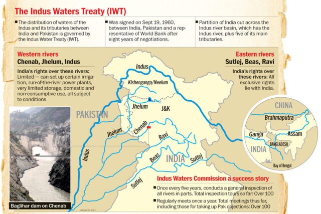
Obviously there is a need for Indian leadership to engage the Chinese. A simple denial from Chinese polity or Water Resources experts would not guarantee a safe future. Perhaps an iron tight international riparian treaty similar to the Indus Water treaty would go a long way in diffusing possibility of future conflict. Since India has been unsuccessful so far would a third party intervention from the UN help? A word of caution however, China was among the only three countries that voted in the UN General Assembly in 1997 against the Convention on the Law of the Non-Navigational Uses of International Water Courses9.


1  Parlung Zangbo River is a major tributary of the Yarlung Zangbo

2  Due to lack of standardization, the Chinese equivalent of the Brahmaputra River is spelt in different texts in various phonetically similar sounding names such as; Yaluzangbo,Yarlungzangbo, Yarlung Zangpo, Yarlung Tsangpo, all the spellings have been used deliberately to be in consonance with the current usages.

3  Scientific American, June 1996

4 http://asiasecurity.macfound.org/images/uploads/news_attachments/Kathmandu_Workshop_Report.pdf [accessed March 18, 2010]

5  The New Nation, 17th January 2010 [ available at http://nation.ittefaq.com/issues/2010/01/17/news0350.htm [accessed on March 20, 2010]]

6  Reshma Patil report from Beijing in Hindustan Times, 26th May 2010

7  The Guardian, 25th May 2010

8  Hindustan Times, November 14, 2006

9  The other two were Burundi and Turkey


Indus Water Treaty

Indus Water Treaty
B.Tech. Project. BTP Supervisor: Manohar Khushalani

Lok Sabha TV conducted a panel discussion on the study on Water Management of the Indus River System and its Implications for India’s Foreign Policy. The invited panelists were Prof. Manohar Khushalani, Sushant Sari  and Akshay Singh.

Manohar Khushalani started the discussion by describing the Indus Water Treaty.

The Indus Waters Treaty is a water-distribution treaty between India and Pakistan, brokered by the World Bank, to use the water available in the Indus System of rivers. It was signed on 19 September 1960 by Jawaharlal Nehru, the then Prime Minister of India, and Ayub Khan, the President of Pakistan.

  • Eastern Rivers
    • Sutlej
    • Beas
    • Ravi
  • Western Rivers
    • Jhelum
    • Chenab
    • Indus

The Treaty gives control over the waters of the three eastern rivers — the Beas, Ravi and Sutlej with a mean annual flow of 33 million acre-feet (MAF) — to India, while control over the waters of the three western rivers — the Indus, Chenab and Jhelum with a mean annual flow of 80 MAF — to Pakistan. According to treaty, all the water of eastern rivers shall be available for unrestricted use in India. India should let unrestricted flow of water from western rivers to Pakistan. This does not mean that India cannot use the western river’s water. They are allowed to use it for limited irrigation and non-consumptive needs such as for generating electricity. This means that the treaty has allocated Pakistan 80 percent of the water from the six-river Indus water system. China has been kept out of the treaty even though Indus originates from Tibet because the topography of the Indus Water System does not allow China to change or stop the flow of the water. Neither of the countries can unilaterally walk out of the pact.

Indus Water Treaty is considered to be one of the most successful water-sharing endeavours in the world today. For 56 years, both India and Pakistan have been peacefully sharing the water of Indus and its tributaries, thanks to The Indus Water Treaty (IWT). But since the ratification, there have been a number of issues raised by both countries over the ethical use of the treaty and the water itself.

India has always treated the security issues and water issues as 2 different subjects.

The discussion also gave insights into the disputes and objections raised over this treaty.

The most frequently raised issue by Pakistan is that India can stop the water flow to Pakistan. Can India stop the water flow to Pakistan? No. Not as per the treaty. India can only utilize the provisions of the treaty to reduce the water flow by a small number but cannot completely stop the flow. India has in fact built many hydro power projects to which Pakistan has objected repeatedly. Even if India decides to reduce the water flow by a large amount, they do not have enough infrastructure to use the additional water and it may even create floods in Kashmir. The decision of not giving water to Pakistan may further enrage the terror elements in the country, making them intensify their attacks on India. This decision can also affect India’s relations with other countries like Nepal and Bangladesh with whom they have water treaties as well. 

Most of the issues have been resolved with legal procedures and mutual understanding from both sides. Though after the 2016 Uri attacks, India threatened to revoke the Indus Water Treaty but so far the threats have not been materialised.

BTP Student: Sejal Kumar, Aysha Fazilath, Vyshakh Dharan, Rahul Patwardhan


India’s Water Emergency

B.Tech Project. BTP Supervisor: Prof. Manohar Khushalani
BTP Students: Sejal Kumar, Aysha Fazilath, Vyshakh Dharan, Rahul Patwardhan

Manohar Khushalani was one of the panelists who appeared live on NDTV for a panel discussion on the water crisis faced in India. This video gives an insight into the problems faced by Indians when it comes to water as well as some expert opinions on this matter. Some of the other panelists are Raghav Chadha, VK Madhavan, Medha Patkar, Dr. Vaman Acharya, and Arunabha Ghosh.

India is facing a major water crisis. People are facing drought-like situations and running out of tap water in major cities like Bengaluru, Chennai and even in the capital, Delhi.

How severe is the water crisis in India?

  1. The 2030 Water Resources Group estimates that if we continue to consume water as per the current rate, India will have only half the water it needs by 2030, which means we’re only 10 years away from reaching this point.
  2. Water being used for agricultural purposes is being over-exploited. According to a recent study, nearly 80 percent of India’s freshwater is being used in agriculture. This number is very high compared to the likes of China and South Africa who use 64 percent and 62 percent respectively.
  3. India is depleting groundwater levels at an alarming rate. Groundwater accounts for 90 percent of the drinking water requirements in rural India and nearly 50 percent in urban areas.
  4. 60 percent of India’s districts have been declared critical on groundwater. This means that they either have poor quality of water or a very limited supply.
  5. As the scarcity of water is increasing day by day, people are resolving to water tankers which are also getting more expensive everyday. This is affecting the lower class drastically.
  6. According to a report, only 15 percent of India’s population receives 85 percent of India’s water. The inequality and discrimination also play a huge role in this crisis.

Raghav Chadha started the discussion by giving facts such as, the water availability has increased in Delhi in the last 4 years from 50 percent of the population receiving usable water to 80 percent. He also said the government is planning to rejuvenate lakes and also create new lakes as resources for freshwater. He also mentioned that the condition of south delhi districts, which earlier faced the problem of clean water and also improper sewage treatment, has now been fixed and will be provided with usable fresh water in the upcoming months.

Prof. Manohar Khushalani mentioned the fact that India as a country consumes more groundwater than any other country. He also stated that water should now be treated as a subject for the central government instead of being treated as a state subject. The states do not have enough coordination and are busy in handling the inter-state water disputes while the residents are still suffering. He also mentioned the fact that there needs to be more research put into methods for getting water from rivers and other sources.

VK Madhavan then gave some key perspectives such as, that the water crisis is caused not only due to excessive use of water but also improper distribution and conservation of water. He argued that the source of tankers that provide water to communities is uncertain, and there are still major areas that don’t have assured access. At a later stage of the discussion he also mentioned that cities are largely dependent on groundwater but do nothing when it comes to implementation methods like drip irrigation to conserve water. India receives a huge amount of rainfall which doesn’t necessarily seep into the ground and thus should be stored and filtered in an efficient manner.

Medha Patkar emphasised on the fact that the current structures and working of dams and related buildings are destroying the rivers. She also highlighted that the government should be focusing more on mini and micro water shedding instead of macro water shedding. She also said that the government’s main strategy should revolve around controlling the access to water on a per house basis and that for major changes the community itself should play a big role.

While water scarcity in India as an issue has not been discussed as topmost important matter, it is high time the people should focus on this subject, or else it’ll be too late to realise and it will affect India and its people way more than it is doing today.

Chennai, the fourth largest city in India, is the worst hit city when it comes to water crisis. Chennai city officials declared that the day when almost no water is left, had been reached, as all the four main reservoirs supplying water to the city had run dry. Two years of deficient monsoon rainfall, with a rainfall deficit of 55 percent, particularly in late 2017 and throughout much of 2018 had led to this crisis. This has impacted millions of people who are left with inconsistent access to water. This is said to be the case of current developed states like Karnataka and Maharashtra in the future. Karnataka has very small amounts of resources left and soon will be piling their hopes on Maharashtra to receive water. On the other hand, Maharashtra because of its size and location, is under immense pressure to provide not only to its residents but also neighbouring states. The rainfall in these 2 states has also started declining in the past few years which only has caused more problems.

Some of the other valuable points that are mentioned by the panellists are; controlling the use of water in the agriculture industry. Sugarcane, which is a crop that depends on water heavily, is grown in parts of the country that have a scarcity of supply. This reduces the availability of water for the people for their personal use; recycling and recharging should be the topmost priority of any water management organisation, i.e. filtering out the water received by rain and distributing that water to the households that don’t have access to groundwater; the yearly monsoon pattern shows that the rain is declining in most parts of India and this also should be a major concern; even though the government is planning on making new residential buildings for development, they are not checked about proper water consumption levels and are sometimes specified with uncertain sources of water so as to receive license to build those structures.


India Gate

India Gate is located in the center of New Delhi in memorial of the British Indian Army who sacrificed their lives in World War I and Anglo-Afghan War fighting for Indian Empire. It was built in command of Edwin Lutyens in 1921.

Amar Jawan Jyoti (the flame of the immortal soldier) is present under the India Gate also known as the Indian Army’s Tomb of unknown soldier. It is burning since 1972. There is a rifle with helmet placed on the shrine along with four tourches that kept burning.

You can see three flags waving at India Gate. Those flags are of Indian Army, Indian Navy and Indian Air Force.

There are names commemorated on India Gate in their memorial of the war dead.

One can reach India Gate by metro or by bus. Neareast metro station is Central Secretariat.

Address: 
Rajpath, India Gate, New Delhi, Delhi 110001


Brandenburg Gate and Holocaust Memorial

The Brandenburg Gate is a neoclassical monument in Berlin, Germany. It was constructed between on the orders of the Prussian King Frederick William II in 1788 and designed by Carl Gotthard Langhans. after the successful restoration of order during the early Batavian Revolution. It was built near the City Gate that was the start of the road from Berlin to the town of Brandenburg.

This gate was built to represent peace replacing the eariler simple guardhouses. It has also played different important political roles in Germany. When the Prussian lost to the Battle of Jena Auerstedt in 1806, Napolean used the gate for triumphal procession. After the Prussian’s comeback in 1814, they defeated Napolean and then redesigned the gate as a Prussian triumphal arch.

In late 20th century, when the revolution of 1989 occurred and the wall was demolished, the gate symbolized freedom and helped in unifying the city of Berlin. For all the murdered jews in the revolution, the German Federal Parliament decided to build a memorial for them which was then designed by Peter Eisenman. This memorial was named Holocaust Memorial.

This memorial consists of a 19,000 m square site covered with 2711 concrete slabs arranged in a grid pattern. There exists an underground place which holds the name of approximately 3 million Jewish Holocaust victims. It’s construction was finished in December, 2004.

Address:
Brandenburg Gate : Pariser Platz, 10117 Berlin, Germany
Holocaust Memorial : Cora-Berliner-Straße 1, 10117 Berlin, Germany


Mehrauli Archaeological Park

Mehrauli Archaeological Park which is in Delhi is one of the only places where you would find not one but many monuments of historical importance.The land which spreads over 200 acres hosts about hundred monuments from multiple dynasty that ruled over Delhi including Khalji dynasty, Tughlaq dynasty, Lodhi Dynasty and the British Raj.

One of the main attractions is Tomb of Balban which was built in 1287 CE as it was the first time for such a true arch and dome to be constructed in India.Some of the notable monuments of the park are :

  • The bastion of Lal Kot fort, Mehrauli.
  • Balban’s tomb, Mehrauli, ca 1287 CE
  • Tomb of Khan Shahid, Balban’s son, Mehrauli.
  • Entrance to Tomb of Khan Shahid, son of Balban
  • Steps of Rajon Ki Baoli
  • Walled mosque adjacent to the Baoli
  • Gandhak ki Baoli, another stepwell beyond Rajon Ki Baoli.
  • Dargah of Sufi saint, Qutbuddin Bakhtiar Kaki, beyond Rajon Ki Baoli.
  • Tomb and wall mosque in Mehrauli Archaeological Park.
  • Bagichi Ki Masjid, Mehrauli.
  • British Agent, Sir Thomas Metcalfe’s Guest House at Dilkusha close to Quli Khan’s tomb.
  • Pavilion tomb and grave platform, Mehrauli Archaeological Park.
  • Tomb in Mehrauli Archaeological Park.
  • Ruined homes near Balban’s tomb

One can reach Lodhi Garden by metro or by bus. Neareast metro station is Qutub Minar.

Address: 
Anuvrat Marg, Opposite Qutub Minar Metro Station, Christian Colony, Mehrauli, New Delhi, Delhi 110030


Lodhi Garden

Lodhi Garden is basically a city park located near the center of New Delhi. Lodi’s ruled northern India including the modern day Pakistan from 1451 – 1526. This site is now protected by Archaeological Survey of India (ASI). Lodi did a lot of architectural works in the 15th century which are now characterised as heritage sites.

  • The Tomb of Mohammad Shah:  It was built in 1444 and is the earliest of the tombs in the garden. Built by Ala-ud-din Alam Shah, this tomb is visible from the roads and it’s architectural shape is octagonal .
  • Sikander Lodi Tomb:  This tomb is similar to the Mohammad Shah’s tomb. It was built by his son, Ibrahim Lodi in 1517. Ibrahim Lodi was the last Sultan of Delhi from Lodi dynasty as he was defeated by Babur. It is the first garden-tomb in India. It is enclosed within a complex having two domes in the shape of umbrella.
  • Bara Gumbad: It is a large rubble-construct dome. It is a gateway to the three domed masjid. It was built by Sikander Lodi in 1490 with a height of 29m. It belongs to a group of monuments that include a Friday mosque. It is believed to be the earliest of all the construction done in Lodi Garden.
  • Shisha Gumbad: It was also built by Sikander Lodi in 1489 – 1517, the exact date is not known. It is named Shisha Gumbad due to the glazed tiles which contains the remains of an unknown family. It houses tombs of an unknown family belonging to the Lodhi Family.

One can reach Lodhi Garden by metro or by bus. Neareast metro station is Jor Bagh.

Address: 
Lodhi Rd, Lodhi Gardens, Lodhi Estate, New Delhi, Delhi 110003


Humayun’s Tomb

The tomb was built on the orders of Humayun’s wife and the chief consort, Bega Begum. It was the first garden-tomb in India and is located in Nizamuddin East, Delhi. Besides the main tomb, there are lots of smaller structures that are present on the pathway which leads our way to the main tomb. The tomb was also declared a UNESCO World Heritage Site in 1993. Since then, it has gone a lot of restoration work.It is the first monument to use red sandstone at such a scale. It was designed by Mirak Mirza Ghiyas and his son. It is placed at the centre of Char Bagh, a 30 acre garden with quadrilateral layout. It also contains a lot of other smaller monuments. Some of them are:

  • Tomb of mosque and Isa Khan: An octagonal tomb present at the pathway to the main tomb.
  • Afsarwala Tomb and Garden: It is present on the southwest end of the complex. It’s actual date of construction is still not known. One of the marble inside the tomb is dated 1566.
  • Nila Gumbad: It stands just outside the boundary of the complex previously known as Nila Burj. It was named this because of its blue glazed tiles. Built by Abdul Rahim Khan-i-Khana.

One can reach Red Fort by metro or by bus although it is more convenient by Metro only. Nearest metro station is Kailash Colony.

Address: 
Mathura Road Opposite, Hazrat Nizamuddin Aulia Dargah, Nizamuddin, New Delhi, Delhi 110013


Red Fort

The Red Fort is a historic fort in New Delhi and was built in 1639. It was built on the orders of the 5th Mughal Emperor Shah Jahan. This fort was actually named Lalkot, meaning Red coat which was the first built city in Delhi. It has massive enclosing walls of red sandstone and is adjacent to Salimgarh Fort. It was designated as a UNESCO World Heritage Site in 2007.

Every year’s Independence day, the Prime Minister hoists the national flag on the Lahore Gate and delivers a national speech. It is one of the most popular tourist destinations in Delhi. Also, it appears on the back of the Rs. 500 note.

The Red Fort has an area of 254 acres enclosed by 2.41km of defensive walls with maximum height of 33m. The kohinoor diamond was a big part of the furnishing. It’s artwork contains styles from India, Europe and Persian resulting in a unique design.

It also has a lot of major structures built inside it, which you can see in the video.

One can reach Red Fort by metro or by bus although it is more convenient by Metro only. Neareast metro station is Chandni Chowk.

Address:
Netaji Subhash Marg, Lal Qila, Chandni Chowk, New Delhi, Delhi 110006